Friday, June 07, 2013

Fort Nelson to Muncho Lake, 6-6-13


Fort Nelson, B.C. to Muncho Lake

We got a better night's sleep last night partly due to our “eyewear.” I had ordered us both eyemasks to wear up here in the “land of the midnight sun.” Since it doesn't get dark here until almost midnight and it gets light again around 4 a.m. So it's hard to get sleep when you are used to having it dark. The fashionable eyewear I got us takes care of that problem.

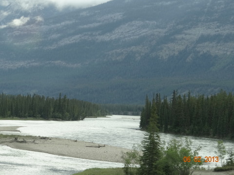
We left this morning and we didn't get too far before we spotted a herd of buffalo/bison out in a meadow. We were quite a ways from them, but I zoomed in for a better shot. We continued on our way and passed some beautifully spectacular scenery. We are in hills and valleys, mountains and plains. We are pretty much seeing it all. Most of the time we are skirting the Northern Canadian Rockies.

We saw a lone animal today who seemed totally confused by us and his surroundings. We thought his mom must be nearby. We weren't sure if it was a moose or a caribou. The owner of the campground where we are parked verified it was a caribou and that it was probably about two years old. And he said they act goofy, so that is probably just his normal state. He also said by that age, they are on their own.
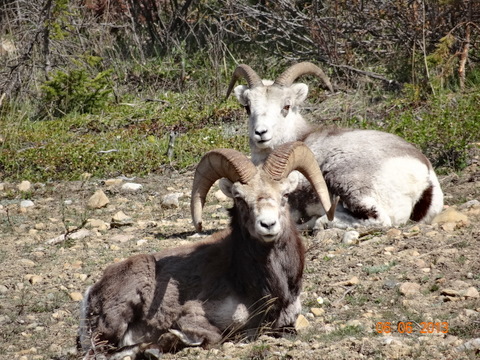
One big treat was big horn sheep. We saw three and they were just sitting looking at us from a short hill. We were quite close to them and they didn't seem too interested in us. Across the road from them were Stone's sheep. I'm not sure why they are called that, but they looked more like goats.

We arrived at Muncho Lake this afternoon. We hadn't covered much more than 150 miles, but we stopped at a couple of way points and met some colorful individuals. We also made several stops to see animals.

Muncho Lake is a natural mountain lake that runs for seven miles. It is narrow for the most part, but deep. Much of the lake is 300 feet deep and goes as deep as 600+ feet. The water was very cold, but it was super clear. There were actually some children camped here with their parents and the children were in the water. The campground owner said they were “locals” which may explain why they could tolerate the cold water. We have a beautiful view from right out our door. We can see across the lake and up the hillside.
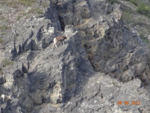
The owner told us we could see sheep on either the mountains in front or behind us and perhaps some mountain goats. He also said that in the morning caribou swim across from the far side of the lake and sometimes come walking up through the camp. Also elk are prevalent and a black bear has frequented the camp recently. We have already seen the sheep. We saw them on the hills behind us. They were far enough away it was hard to see, but I did get some shots on my camera. We are hoping to see some moose or caribou yet.

We had a great campsite tonight, but we had no wifi, so this post will be a day late.

Till next time. . .

Dale

Thursday, June 06, 2013

Dawson Creed to Fort Nelson, British Columbia

6-5-13 Blog

Dawson Creek to Fort Nelson, British Columbia
The day began with some sprinkles of raindrops, so Terry wanted to get stuff picked up outside before it all got too wet. We had a long day of driving and we got started about 8 a.m.

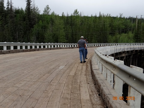
We drove up the Alaska Highway and our first stop required us to turn off the road onto a portion of the original Alaska Highway. We found the Kiskatinaw Bridge on this stretch of road. It is one of the last remaining remnants of the original construction of the highway. It is the longest wood curved bridge in North American and spans the Kiskatinaw River.
During WW II, with the building of the Alaska Highway, the Kiskantinaw River presented a hindrance. The location of the bridge site, which was near a hairpin turn on the river, forced construction of a curved right-of-way. Engineers developed this 190 foot wooden bridge with a superelevated (banked) nine degree curve to conform with the bend of the highway.

Constructed by a Canadian company, the building of the engineering marvel took nine months to complete. It was the first curved wooden bridge built in Canada and today, it is the only curved, banked trestle bridge remaining and still in use in Western Canada.

It was pretty cool and we took some pictures. The one picture is of what looks like giant pegs that are used to hold it together. It is an amazing structure.

We drove on and marveled once again at the scenery in this part of the world. We saw lots of signs warning us of wildlife, caribou, deer and moose. However, the only animals we saw were the images on the signs. LOL

We stopped at Sasquatch Crossing and got our pictures taken. Hope we don't meet any real ones. Hah!

We are camped in Fort Nelson, B.C. The camp is behind a motel and needs some work, but it is adequate. You pay big prices for any campsites in this part of the world whether they are nice or not. It is what it is.

Our weather for the last couple days has been 70 degrees or above.

Till next time. . .

Dale

Tuesday, June 04, 2013

Dawson Creek, British Columbia

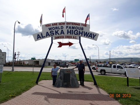
Today we played tourist and went to the visitor's bureau here in Dawson Creek. We had our pictures taken at the Alaska Highway Marker and also took pictures of the Mile "0" marker a couple blocks away. We are really pumped for this trip, but starting out tomorrow from mile "0" means we will be counting down the miles till we get to Alaska. If all goes well, we will be arriving in Alaska proper on June 13. We have already traveled about 2862 miles already and we figured the total trip will be about 10,000 miles. Whew!

We went in to Walmart to get a few supplies. Back at the camp, we had some lunch. Terry and I went back into town later then to find the health food store. It was not easy to find, but we finally got there and I bought some gluten free bread.

It has been beautiful here today. It rained yesterday, but today was sunny all day and in the mid 70's. After almost two weeks of rain and wind, it was a welcome respite. When we were in the supermarket, we overheard two women complaining about the "heat." LOL


This camp, Northern Lights is up on a hill on the outskirts of town. It has full hookups and a beautiful bathhouse. . . the nicest I have seen in a long time. The laundry room is all new with new appliances. Very nice.

We leave here tomorrow and drive 300 miles or so to Fort Nelson. The roads are supposed to be good.

Till next time. . .

Dale

Monday, June 03, 2013

Mile "0" on the Alaska Highway!


We left Grande Cache this morning and fueled and started rolling. It was raining again. . . we have been in rain most of the two weeks since we left. But we are supposed to have a nice day tomorrow and it actually did clear up late in the afternoon today.

We drove with hills on both sides of us today, much like going through a valley. We also had periods of time where we were traveling through what looked mostly like forest. Very few houses, except in the two towns we went through, but there is a lot of gas and oil production up here. Probably more gas than anything else. . . and wood. There was an OSB plant we passed outside of Grande Prairie. It was huge and I wondered where the people lived who worked there. When we drove into the town, there were new subdivisions being built with large houses, so there are people who live here and industries to support.

At one point while driving Terry spotted a moose down in the river. I looked quickly enough to get a glance. The picture is blurry, but I had to post it to prove we saw the moose. We were moving at speed and I had traffic behind me so I couldn't slow down.

We arrived at Dawson Creek, which is Mile "0" on the Alaska Highway. It is where the mile markers start. We are still almost 1,000 from Alaska, but we are closer than we were! We are staying here for two nights at the Northern Lights RV Park to rest up and then on Wednesday we have a 300 mile trip to Fort Nelson.


Till next time. . .

Dale


Sunday, June 02, 2013

Whistler's Camp, Jasper National Park to Grande Cache, Alberta


We were ready early this morning, part due to the fact that we had no hookups, so we didn't go through all our normal morning rituals. LOL


We drove through Jasper on our way and found it similar to Canmore and Banff.

We continued our drive out of the Jasper National Park and headed to Hinton, where Terry got his week's allotment of walnut crunch bars. I can say that it is the only Tim Horton's we've been to that had his "melt in your mouth" confectionery. So he bought all they had. LOL

We were actually driving out of the mountains today, so the scenery was different than yesterday's, but still noteworthy.


 We saw some deer again.
Tab took the point today, so Terry got a pix of his coach as we were following. We had intermittent rain today. What surprises you about that?

We are at the Grande Cache Municipal Park Campground tonight in Grande Cache, Alberta. I haven't gotten a picture of camp yet because it is raining as I write. Maybe I will be able to add one later.

Tomorrow we head to Dawson Creek, British Columbia, for two nights. That is the "0" mile marker on the Alcan Highway. Picture for sure!

Till next time. . .

Dale

Banff and Jasper National Parks, Icefields Highway

-->This post is for Saturday, June 1, 2013. We had no internet connection last night, so it is posted late.
 We spent Friday night in Canmore, Alberta, just a few miles from Banff. We had decided to try and make it this far so that on Saturday, the only day in the forecast that called for sunshine, we could drive the road through Banff National Park and the Icefields Highway through Jasper National Park. While it did rain on us all evening at the camp, we did awake to beautiful, glorious sunshine.
 This little guy was getting his breakfast while I was out taking pictures!
Tab and Deanna wanted to sleep in a bit, so we headed into town to check out the shops. The towns of Canmore and Banff look like small European alpine villages. They are beautiful and full of shops that want your money. LOL We walked around a bit and ran into Tab and Deanna. Hah! We decided to start our day of driving into the Banff and Jasper National Parks, so off we went. Our destination for the day was the Columbia Icefields.

The drive was spectacular. We got off the Trans-Canadian Highway and drove the Bow Trail Parkway, which is the route through the mountains that is two-lane and much slower than the highway. But that is where we hoped to see animals and other scenic events. We were not disappointed.


The first wildlife came into view not long after . . . in the form of deer. I know, we see a lot of deer, but we never tire of seeing them in the wild. A short time later, we saw several cars pulled over to the side of the road and a black bear was grazing by the side of the road. It may look like I'm close to him, but I used my optical/digital zoom on my new camera and I am not close at all.


Our next stop was Lake Louise to see the chateau and we arrived about lunch time. We parked and took a short hike down to the lake. The waters are incredibly clear and a green/blue in color. The chateau/hotel is beautiful, but it is more impressive in the pictures you see on line that are taken from the air. But it is still lovely. There are two glaciers visible on the far side of the lake. Upper Victoria glacier and Lower Victoria glacier.


Back on the road we saw incredible mountain scenery as the road goes between the peaks. We stopped to view some waterfalls and Tab saw what he thought were mountain goats on the far peaks. It is hard to say how far away they were because they were across the valley and up the mountain. But they were mountain goats. So I got some pix. I was wishing they were closer. . . and soon my wish was granted with two big mountain goats grazing by the side of the road.


On we drove till we arrived at the Columbia Icefields Interpretive Center. This was to be our boondocking spot for the night. But there is a reason the biggest glacier around is here and that is because it was cold . . . and windy. As soon as we stepped out, we grabbed our winter gear for the walk up  to the center. I snapped a couple pix and you can see the bus/tractor they take out onto the glacier. We didn't take the tour because we now decided we wanted to drive further as we were sure we would not have been able to stay warm enough up in the mountains with wind blowing cold air at us from the glacier.


So on we went. We stopped at Whistler's camp near Jasper for the night. It is in the national park and they have full hookups, but not at the time we checked in, about 7:30 p.m. It had been a long day of driving, full of wonderful memories, and we were too tired to drive on, so we took a couple no hookup sites for the night. It wasn't as cold there as on the mountain so we got along fine. Our reward was seeing an elk momma and her yearling walking through our camp. How cool is that?

Till next time. . . 

Dale


Saturday, June 01, 2013

A long day, but we made it to Canmore, Alberta!

We started out today with heading to the glass shop to get  new windshield for Tab and Deanna. We got there at 8:30 and they brought their important stuff over to our motorhome. Then we went and fueled up MinnieMee and bought some potatoes.We had thought we would have problems bringing potatoes across the border, so we waited till we got here to buy some.

Fort Macleod is a small town and there isn't much going on, so we just took our time getting back to the glass shop. Along the way we stopped at a cafe downtown, the only thing open there, and had a bite to eat. When we got back to the shop, they said the rig would be done at 12:30 and they would be able to drive it. We thought it might have to sit for awhile, but that was not the case.

We decided then that we would try to drive up toward Calgary and get some distance behind us. So at 12:30, Tab and Deanna got their coach back and we headed north. We went over west a bit and took highway 22, which is known as the cowboy trail. There are very few towns, but a lot of ranches on this road. It runs along the foothills of the Canadian Rockies, so their is a lot of beautiful scenery. Unfortunately there is a lot of truck traffic and less than an hour into our journey today, we took a rock to the windshield. Bummer. But the fortunate thing is that it appears to have not penetrated the glass but left a large scratch. So nothing needs to be done with it.

The day before we had seen numerous campgrounds along the highway, but not today.We thought we would be able to find one and just pull off and camp. Instead we drove and drove. We ended up in Canmore, Alberta, which is very close to Banff. Today we will be doing some sightseeing in Canmore, then will start driving toward Banff and the Icefields Highway.

The mountains are surrounding our camp here in Canmore. It is cold this morning, but beautiful.

Till next time. . .


Dale